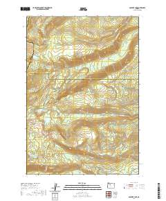
2020 Map of Boulder Lake
USGS Topo · Published 2020About this map
Badger Butte and Lookout Butte dominate this high-elevation landscape along the border of Marion, Wasco, and Jefferson counties. The map centers on a series of glacial lakes and high-altitude basins, including the namesake Boulder Lake and the nearby Trout Lake. This remote region is defined by its complex drainage systems, where headwaters such as the N Fork Boulder Creek and S Fork Boulder Creek converge.
Find a feature on this map
56 named features on this map. Tap any name to fly to it.
Don’t see what you’re looking for? This feature index may not catch every label — zoom into the map to look around manually.
Map Details
Editions of this 2020 Boulder Lake Map
This is the sole edition of this map. No revisions or reprints were ever made.
Other maps of this area

1927 · Mt. Jefferson
USGS Topo · 1:125,000

1930 · Mt. Jefferson
USGS Topo · 1:125,000

1955 · Bend
USGS Topo · 1:250,000

1957 · Bend
USGS Topo · 1:250,000

1958 · Bend
USGS Topo · 1:250,000

1961 · Whitewater River
USGS Topo · 1:62,500

1961 · Fort Butte
USGS Topo · 1:62,500
1961 · Mt. Jefferson
USGS Topo · 1:62,500
1961 · Breitenbush Hot Springs
USGS Topo · 1:62,500
1983 · Madras
USGS Topo · 1:100,000