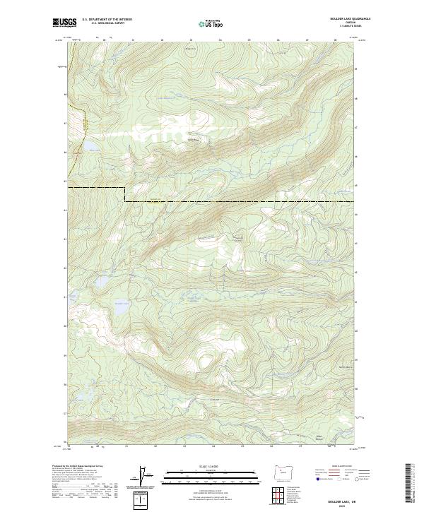
2023 Map of Boulder Lake
USGS Topo · Published 2023About this map
Boulder Lake and its surrounding alpine basins define this high-elevation landscape where the boundaries of Marion, Wasco, and Jefferson counties converge. The terrain is characterized by a network of glacial lakes and volcanic features, including Cinder Cone and Badger Butte. These peaks and water bodies are linked by a complex system of remote forest routes such as NW Trout Lake Rd and BIA Rd 33, providing access to the high meadows.
Find a feature on this map
45 named features on this map. Tap any name to fly to it.
Don’t see what you’re looking for? This feature index may not catch every label — zoom into the map to look around manually.
Map Details
Editions of this 2023 Boulder Lake Map
This is the sole edition of this map. No revisions or reprints were ever made.
Other maps of this area

1927 · Mt. Jefferson
USGS Topo · 1:125,000

1930 · Mt. Jefferson
USGS Topo · 1:125,000

1955 · Bend
USGS Topo · 1:250,000

1957 · Bend
USGS Topo · 1:250,000

1958 · Bend
USGS Topo · 1:250,000

1961 · Whitewater River
USGS Topo · 1:62,500

1961 · Fort Butte
USGS Topo · 1:62,500
1961 · Mt. Jefferson
USGS Topo · 1:62,500
1961 · Breitenbush Hot Springs
USGS Topo · 1:62,500
1983 · Madras
USGS Topo · 1:100,000