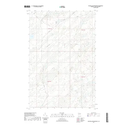
2019 Map of Boulder Lake Reservoir NE
USGS Topo · Published 2019About this map
The Cloquet River and the S Br Whiteface River define this portion of Saint Louis County, documenting a landscape where water and wetlands dominate the geography. In this 2019 survey, the network of timber-access roads and trails, such as Marshall Truck Trl and Camp 26 Trl, provides a look at the modern forest management infrastructure of Ault Township. Small, remote water bodies like Huligan Lake, Schirp Lake, and Quick Lake are scattered across the terrain, connected by minor streams including Masse Cr and Bug Cr. Local routes like Brimson Rd and Co Hwy 4 serve as the primary conduits through this sparsely settled region, where historical land divisions of T55N and T54N meet.
Find a feature on this map
29 named features on this map. Tap any name to fly to it.
Don’t see what you’re looking for? This feature index may not catch every label — zoom into the map to look around manually.
Map Details
Editions of this 2019 Boulder Lake Reservoir NE Map
This is the sole edition of this map. No revisions or reprints were ever made.
Other maps of this area

1953 · Boulder Lake Reservoir
USGS Topo · 1:24,000

1954 · Barrs Lake
USGS Topo · 1:24,000

1954 · Thompson Lake
USGS Topo · 1:24,000

1954 · Two Harbors
USGS Topo · 1:250,000

1954 · Hibbing
USGS Topo · 1:250,000

1956 · Pequaywan Lake
USGS Topo · 1:24,000

1957 · Two Harbors
USGS Topo · 1:250,000

1957 · Hibbing
USGS Topo · 1:250,000

1957 · Brimson
USGS Topo · 1:62,500

1957 · Markham
USGS Topo · 1:62,500