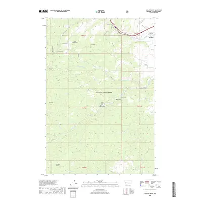
2020 Map of Boulder West
USGS Topo · Published 2020About this map
Deerlodge National Forest covers much of this Western landscape, where the rugged topography of the Elkhorn Mountains meets the Boulder River valley. The town of Boulder serves as a small hub in the northeast corner, positioned where the river flows past distinctive landmarks like Pulpit Rock. Evidence of the area's grazing and mining history is found in labels such as Cattle Drive Rd, Galena Park, and Little Galena Gulch.
Find a feature on this map
44 named features on this map. Tap any name to fly to it.
Don’t see what you’re looking for? This feature index may not catch every label — zoom into the map to look around manually.
Map Details
Editions of this 2020 Boulder West Map
This is the sole edition of this map. No revisions or reprints were ever made.
Other maps of this area

1889 · Helena
USGS Topo · 1:250,000

1893 · Helena
USGS Topo · 1:250,000

1899 · Boulder
USGS Topo · 1:125,000

1899 · Helena
USGS Topo · 1:250,000

1903 · Helena
USGS Topo · 1:250,000

1947 · Butte
USGS Topo · 1:250,000

1950 · Jefferson City
USGS Topo · 1:62,500

1954 · Elk Park
USGS Topo · 1:62,500

1954 · Basin
USGS Topo · 1:62,500

1954 · Boulder
USGS Topo · 1:62,500