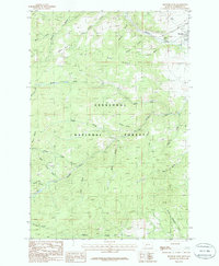
1985 Map of Boulder West
USGS Topo · Published 1986About this map
The Boulder settlement sits at the edge of a landscape defined by the convergence of mountain drainages and high ridges in Jefferson County. During the mid-1980s, this area served as a transition point between the developed valley and the extensive timberlands of the Deerlodge National Forest. The geography is carved by a complex network of waterways, most notably the Boulder River and the Little Boulder River, which are joined by numerous tributaries including Galena Gulch and Tesky Creek.
Find a feature on this map
28 named features on this map. Tap any name to fly to it.
Don’t see what you’re looking for? This feature index may not catch every label — zoom into the map to look around manually.
Map Details
Editions of this 1985 Boulder West Map
This is the sole edition of this map. No revisions or reprints were ever made.
Other maps of this area

1889 · Helena
USGS Topo · 1:250,000

1893 · Helena
USGS Topo · 1:250,000

1899 · Boulder
USGS Topo · 1:125,000

1899 · Helena
USGS Topo · 1:250,000

1903 · Helena
USGS Topo · 1:250,000

1947 · Butte
USGS Topo · 1:250,000

1950 · Jefferson City
USGS Topo · 1:62,500

1954 · Elk Park
USGS Topo · 1:62,500

1954 · Basin
USGS Topo · 1:62,500

1954 · Boulder
USGS Topo · 1:62,500