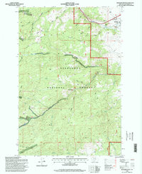
1996 Map of Boulder West
USGS Topo · Published 1998About this map
Deerlodge National Forest covers much of this landscape, where high peaks like Mount Pisgah overlook a complex network of gulches and drainages. The Little Boulder River and its various tributaries, including the North Fork Little Boulder River and West Fork Little Boulder River, carve through the terrain, supporting recreation sites like the Elder Creek Picnic Area. The northeastern corner transitions into the community of Boulder, showing the intersection of local infrastructure and the surrounding wilderness.
Find a feature on this map
39 named features on this map. Tap any name to fly to it.
Don’t see what you’re looking for? This feature index may not catch every label — zoom into the map to look around manually.
Map Details
Editions of this 1996 Boulder West Map
This is the sole edition of this map. No revisions or reprints were ever made.
Other maps of this area

1889 · Helena
USGS Topo · 1:250,000

1893 · Helena
USGS Topo · 1:250,000

1899 · Boulder
USGS Topo · 1:125,000

1899 · Helena
USGS Topo · 1:250,000

1903 · Helena
USGS Topo · 1:250,000

1947 · Butte
USGS Topo · 1:250,000

1950 · Jefferson City
USGS Topo · 1:62,500

1954 · Elk Park
USGS Topo · 1:62,500

1954 · Basin
USGS Topo · 1:62,500

1954 · Boulder
USGS Topo · 1:62,500