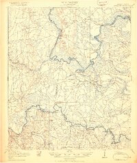
1919 Map of Boulogne
USGS Topo · Published 1919About this map
St Marys River and the Satilla River carve deep, winding paths through this coastal plain landscape along the Georgia-Florida border. The 1917 survey reveals a region defined by its waterway commerce, evidenced by the high concentration of river landings such as White Sand Ldg, Elbow Ldg, and Mallets Ldg. Transportation inland is anchored by the Atlantic Coast Line R R and the Lumber R R, which cut through dense areas like Cabbage Swamp and Tybee Swamp.
Find a feature on this map
70 named features on this map. Tap any name to fly to it.
Don’t see what you’re looking for? This feature index may not catch every label — zoom into the map to look around manually.
Map Details
Editions of this 1919 Boulogne Map
3 editions found

Other maps of this area

1917 · Nahunta
USGS Topo · 1:62,500

1917 · Boulogne
USGS Topo · 1:62,500

1917 · Hilliard
USGS Topo · 1:62,500

1918 · St Marys
USGS Topo · 1:62,500

1918 · Folkston
USGS Topo · 1:62,500

1918 · Moniac
USGS Topo · 1:62,500

1918 · Nahunta
USGS Topo · 1:62,500

1918 · Bladen
USGS Topo · 1:62,500

1918 · Kingsland
USGS Topo · 1:62,500

1919 · St Marys
USGS Topo · 1:62,500