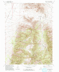
1993 Map of Boulter Peak
USGS Topo · Published 1993About this map
The East Tintic Mountains dominate this high-altitude landscape where the borders of Tooele and Utah counties meet the northern edge of Juab County. This survey reveals a terrain defined by mid-century extraction, centered on the Scranton Mine in Barlow Canyon. The complex topography is marked by numerous prospects and specialized operations like the New Bullion Mine and the Silver Dollar Mine, reflecting the intensive mining history of the Tintic District.
Find a feature on this map
35 named features on this map. Tap any name to fly to it.
Don’t see what you’re looking for? This feature index may not catch every label — zoom into the map to look around manually.
Map Details
Editions of this 1993 Boulter Peak Map
This is the sole edition of this map. No revisions or reprints were ever made.
Other maps of this area

1885 · Sevier Desert
USGS Topo · 1:250,000

1885 · Tooele Valley
USGS Topo · 1:250,000

1947 · Fivemile Pass
USGS Topo · 1:62,500

1947 · Allens Ranch
USGS Topo · 1:24,000

1947 · Boulter Peak
USGS Topo · 1:24,000

1947 · Goshen Pass
USGS Topo · 1:24,000

1949 · Eureka
USGS Topo · 1:24,000

1949 · Allens Ranch
USGS Topo · 1:24,000

1949 · Fivemile Pass
USGS Topo · 1:24,000

1949 · Goshen Pass
USGS Topo · 1:24,000