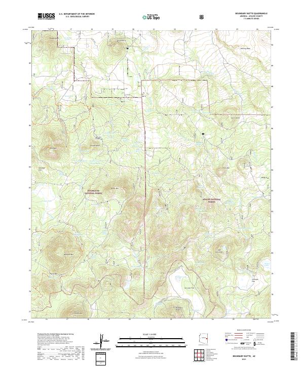
2021 Map of Boundary Butte
USGS Topo · Published 2021About this map
The rugged intersection of the Sitgreaves National Forest and Apache National Forest dominates this topographic study of eastern Arizona. The terrain is marked by a complex system of livestock tanks and springs, such as Ojo Bonito Tank and Goodman Spring, which supported the ranching history of the high plateau. In the northern reaches, the Vernon Cem remains a quiet marker of local history near Serviceberry Hill. Cultural activity is further evidenced by the industrial footprint of the Aniceto Cinder Pit and an extensive network of historic pathways, including the Land Of The Pioneers Trl and Pioneers Shortcut #1 Trl. These routes, alongside the Los Burros Trl, trace the movement of early settlers through the high-elevation forests and volcanic features like Aniceto Knoll.
Find a feature on this map
82 named features on this map. Tap any name to fly to it.
Don’t see what you’re looking for? This feature index may not catch every label — zoom into the map to look around manually.
Map Details
Editions of this 2021 Boundary Butte Map
This is the sole edition of this map. No revisions or reprints were ever made.
Other maps of this area

1886 · St Johns
USGS Topo · 1:250,000

1892 · St Johns
USGS Topo · 1:250,000

1954 · Saint Johns
USGS Topo · 1:250,000

1957 · Saint Johns
USGS Topo · 1:250,000

1958 · Saint Johns
USGS Topo · 1:250,000

1961 · McNary
USGS Topo · 1:62,500

1962 · Saint Johns
USGS Topo · 1:250,000

1968 · Boundary Butte
USGS Topo · 1:24,000

1969 · Whiting Knoll
USGS Topo · 1:24,000
1969 · Horseshoe Cienega
USGS Topo · 1:24,000