
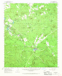
1961 Map of McNary
USGS Topo · Published 1963About this map
The rugged boundary between the Sitgreaves National Forest and the Apache Indian Reservation defines this mountain landscape, following the prominent Mogollon Rim through the central portion of the survey. The settlement of Mc Nary serves as a hub for the region's timber-related infrastructure, situated near the Forestry Station and a local Fish Hatchery. Northward, the growing communities of Lakeside and Pinetop are anchored by water resources such as Rainbow Lake, Scott Reservoir, and Woodland Reservoir.
Find a feature on this map
108 named features on this map. Tap any name to fly to it.
Don’t see what you’re looking for? This feature index may not catch every label — zoom into the map to look around manually.
Map Details
Editions of this 1961 McNary Map
2 editions found
Other maps of this area

1886 · St Johns
USGS Topo · 1:250,000

1886 · Holbrook
USGS Topo · 1:250,000

1892 · St Johns
USGS Topo · 1:250,000

1893 · Holbrook
USGS Topo · 1:250,000

1954 · Holbrook
USGS Topo · 1:250,000

1954 · Clifton
USGS Topo · 1:250,000

1954 · Saint Johns
USGS Topo · 1:250,000

1954 · Mesa
USGS Topo · 1:250,000

1957 · Mesa
USGS Topo · 1:250,000

1957 · Holbrook
USGS Topo · 1:250,000