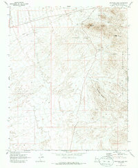
1970 Map of Boundary Cone
USGS Topo · Published 1986About this map
Gold mining operations and exploration claims dominate this 1970 landscape within the Black Mountains of Mohave County. The terrain is defined by jagged peaks and dry washes, centering on the distinctive volcanic landmark of Boundary Cone. This area was a flurry of activity for decades, evidenced here by a high density of named shafts and claims including the United Oatman Mine, Oatman Southern Mine, and Oatman Syndicate Mine.
Find a feature on this map
21 named features on this map. Tap any name to fly to it.
Don’t see what you’re looking for? This feature index may not catch every label — zoom into the map to look around manually.
Map Details
Editions of this 1970 Boundary Cone Map
3 editions found
Other maps of this area

1886 · Camp Mohave
USGS Topo · 1:250,000

1892 · Camp Mohave
USGS Topo · 1:250,000

1903 · Needles
USGS Topo · 1:125,000

1904 · Needles Special
USGS Topo · 1:125,000

1926 · Mohave City
USGS Topo · 1:96,000

1942 · Camp Mohave
USGS Topo · 1:250,000

1947 · Kingman
USGS Topo · 1:250,000

1948 · Kingman
USGS Topo · 1:250,000

1950 · Davis Dam
USGS Topo · 1:62,500

1950 · Needles
USGS Topo · 1:62,500