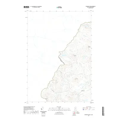
2021 Map of Boundary Pond
USGS Topo · Published 2021About this map
The international border between the United States of America and Canada defines the western edge of this survey, carving a jagged path through the high terrain of Franklin County. At the southern end of the sheet, Lowelltown sits as a lonely human outpost in an otherwise water-rich landscape dominated by the headwaters of the Moose River. This area is characterized by a dense network of isolated water bodies, ranging from the high-elevation Unknown Pond in the north to the tucked-away Beattie Pond in the south, suggesting a region shaped by timber interests and backcountry recreation.
Find a feature on this map
20 named features on this map. Tap any name to fly to it.
Don’t see what you’re looking for? This feature index may not catch every label — zoom into the map to look around manually.
Map Details
Editions of this 2021 Boundary Pond Map
This is the sole edition of this map. No revisions or reprints were ever made.
Other maps of this area

1928 · Chain Lakes
USGS Topo · 1:48,000

1928 · Skinner
USGS Topo · 1:48,000

1931 · Skinner
USGS Topo · 1:62,500

1932 · Arnold Pond
USGS Topo · 1:48,000

1932 · Chain Lakes
USGS Topo · 1:62,500

1935 · Chain Lakes
USGS Topo · 1:62,500

1935 · Arnold Pond
USGS Topo · 1:62,500

1949 · Jackman
USGS Topo · 1:250,000
1951 · Chain Lakes
USGS Topo · 1:50,000

1963 · Jackman
USGS Topo · 1:250,000