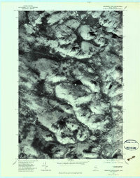
1977 Map of Boundary Pond
USGS Topo · Published 1983About this map
Boundary Pond and the surrounding borderlands of Franklin County, Maine, are captured in this 1977 orthophotoquad, which reveals a landscape defined by timber, water, and international proximity. Unlike a traditional topographic map, this imagery showcases the actual texture of the forest floor and the carved paths of the Moose River and Riviere Kokombis as they cross the terrain. The presence of Lowelltown provides a historical anchor in an area otherwise characterized by high peaks and remote water bodies. This specific edition uses aerial photography to detail the transit corridors such as Keenes, offering researchers a precise look at the land use and accessibility in the late seventies. Significant peaks like Mont Round Top and Dome Mountain dominate the northern and eastern horizons, framing the watershed of the Riviere Nebnellis.
Find a feature on this map
10 named features on this map. Tap any name to fly to it.
Don’t see what you’re looking for? This feature index may not catch every label — zoom into the map to look around manually.
Map Details
Editions of this 1977 Boundary Pond Map
This is the sole edition of this map. No revisions or reprints were ever made.
Other maps of this area

1928 · Chain Lakes
USGS Topo · 1:48,000

1928 · Skinner
USGS Topo · 1:48,000

1931 · Skinner
USGS Topo · 1:62,500

1932 · Arnold Pond
USGS Topo · 1:48,000

1932 · Chain Lakes
USGS Topo · 1:62,500

1935 · Chain Lakes
USGS Topo · 1:62,500

1935 · Arnold Pond
USGS Topo · 1:62,500

1949 · Jackman
USGS Topo · 1:250,000
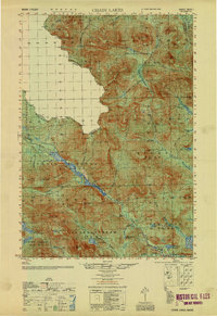
1951 · Chain Lakes
USGS Topo · 1:50,000

1963 · Jackman
USGS Topo · 1:250,000