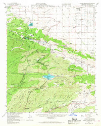
1958 Map of Bouquet Reservoir
USGS Topo · Published 1969About this map
The Bouquet Reservoir and the high-altitude basins of the Sierra Pelona range dominate this late-1950s landscape within the Angeles National Forest. Water infrastructure is central to the area's development, seen in the Fairmont Reservoir and its Intake Tower, along with the San Francisquito Powerhouse No 1. These features reflect the complex hydraulic engineering required to manage resources across the Sierra Pelona Ridge.
Find a feature on this map
97 named features on this map. Tap any name to fly to it.
Don’t see what you’re looking for? This feature index may not catch every label — zoom into the map to look around manually.
Map Details
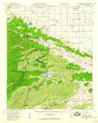
Editions of this 1958 Bouquet Reservoir Map
2 editions found
Other maps of this area

1900 · Tujunga
USGS Topo · 1:62,500

1900 · Fernando
USGS Topo · 1:62,500

1901 · Southern California Sheet No. 1
USGS Topo · 1:250,000

1903 · Tejon
USGS Topo · 1:125,000

1903 · Camulos
USGS Topo · 1:125,000

1903 · Santa Susana
USGS Topo · 1:62,500

1904 · Southern California Sheet No. 1
USGS Topo · 1:250,000

1915 · Elizabeth Lake
USGS Topo · 1:125,000

1917 · Elizabeth Lake
USGS Topo · 1:125,000

1929 · Saugus
USGS Topo · 1:24,000