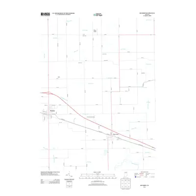
2013 Map of Bourbon
USGS Topo · Published 2013About this map
Bourbon and Etna Green anchor this portion of Marshall County, showing a landscape defined by highly organized agriculture and a sophisticated drainage network. The southern edge of the map is dominated by the winding course of the Tippecanoe River, which stands in stark contrast to the straight, engineered lines of numerous waterways like Danner Ditch, Moore Ditch, and Robinson Ditch. These ditches reflect the historical transformation of northern Indiana’s wetlands into productive farmland.
Find a feature on this map
82 named features on this map. Tap any name to fly to it.
Don’t see what you’re looking for? This feature index may not catch every label — zoom into the map to look around manually.
Map Details
Editions of this 2013 Bourbon Map
This is the sole edition of this map. No revisions or reprints were ever made.
Other maps of this area

1953 · Fort Wayne
USGS Topo · 1:250,000

1953 · Chicago
USGS Topo · 1:250,000

1956 · Fort Wayne
USGS Topo · 1:250,000

1957 · Chicago
USGS Topo · 1:250,000

1957 · Inwood
USGS Topo · 1:24,000

1958 · Bremen
USGS Topo · 1:24,000

1958 · Nappanee West
USGS Topo · 1:24,000

1958 · Nappanee East
USGS Topo · 1:24,000

1958 · Bourbon
USGS Topo · 1:24,000

1959 · Atwood
USGS Topo · 1:24,000