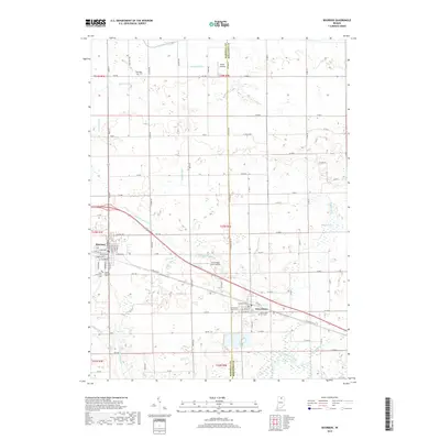
2019 Map of Bourbon
USGS Topo · Published 2019About this map
Bourbon and Etna Green anchor this northern Indiana landscape, where the flat agricultural terrain is defined by an extensive network of drainage infrastructure. This intricate system includes the Lemer-Berger Ditch, Kinzie Ditch, and Dausman Ditch, all designed to manage the watershed as it moves toward the Tippecanoe River in the southern portion of the quadrangle. The map captures the interface between these established towns and the surrounding rural acreage, which is dotted with sites of local historical significance such as Sandridge Cem and Parks Memorial Cem. Moving east toward the Marshall Co Kosciusko Co line, the geography transitions into a lake-inflected landscape near Mud Lake and the settlement of Rust's Landing. Notable transportation and utility features like the E-Lincoln Hwy and the Arrowhead Farm Airport reflect the area's ongoing connection to regional transit corridors.
Find a feature on this map
74 named features on this map. Tap any name to fly to it.
Don’t see what you’re looking for? This feature index may not catch every label — zoom into the map to look around manually.
Map Details
Editions of this 2019 Bourbon Map
This is the sole edition of this map. No revisions or reprints were ever made.
Other maps of this area

1953 · Fort Wayne
USGS Topo · 1:250,000

1953 · Chicago
USGS Topo · 1:250,000

1956 · Fort Wayne
USGS Topo · 1:250,000

1957 · Chicago
USGS Topo · 1:250,000

1957 · Inwood
USGS Topo · 1:24,000

1958 · Bremen
USGS Topo · 1:24,000

1958 · Nappanee West
USGS Topo · 1:24,000

1958 · Nappanee East
USGS Topo · 1:24,000

1958 · Bourbon
USGS Topo · 1:24,000

1959 · Atwood
USGS Topo · 1:24,000