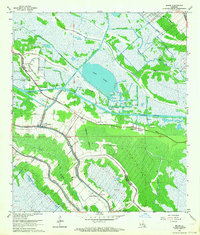
1963 Map of Bourg
USGS Topo · Published 1964About this map
Bourg and the surrounding coastal marshlands of Terrebonne and Lafourche Parishes appear here during a period of significant extraction and maritime transport. The landscape is defined by the complex engineering of the Intracoastal Waterway and the Company Canal, which cut through the natural geography of Grand Bayou and Bayou Blue. These waterways supported the Bourg Gas Field and Lake Long Oil And Gas Field, visible alongside numerous individual drill holes.
Find a feature on this map
34 named features on this map. Tap any name to fly to it.
Don’t see what you’re looking for? This feature index may not catch every label — zoom into the map to look around manually.
Map Details
Editions of this 1963 Bourg Map
2 editions found
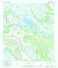
Other maps of this area

1892 · Cut-Off
USGS Topo · 1:62,500

1892 · Houma
USGS Topo · 1:62,500

1894 · Lake Felicity
USGS Topo · 1:62,500

1894 · Dulac
USGS Topo · 1:62,500

1932 · Houma SE
USGS Topo · 1:31,680

1932 · Houma SW
USGS Topo · 1:31,680

1932 · Houma NE
USGS Topo · 1:31,680

1932 · Houma NW
USGS Topo · 1:31,680

1935 · Viguerie Canal
USGS Topo · 1:31,680

1935 · Montegut
USGS Topo · 1:31,680