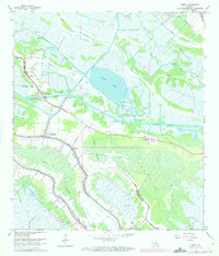
1963 Map of Bourg
USGS Topo · Published 1975About this map
Bourg sits at the nexus of the Intracoastal Waterway and natural bayous in the mid-1960s, reflecting a landscape shaped by both ancient waterways and modern industrial demands. The map reveals a transition from traditional bayou-side settlements to active energy extraction, prominently featuring the Bourg Gas Field and numerous drill holes scattered across the marshy terrain. Local life is anchored by family and faith, with landmarks such as Matherne Cem, St Elie Cem, and The Methodist Ch serving the communities of Klondyke and Grandbois. The presence of a Ferry crossing the waterway near Bourg underscores the era's infrastructure before widespread bridge construction. Extensive canal systems like the Company Canal and St Louis Canal cut through the wetlands toward Lake Long, illustrating the human effort to navigate and drain the complex delta environment of Terrebonne Parish.
Find a feature on this map
36 named features on this map. Tap any name to fly to it.
Don’t see what you’re looking for? This feature index may not catch every label — zoom into the map to look around manually.
Map Details
Editions of this 1963 Bourg Map
2 editions found
Other maps of this area

1892 · Cut-Off
USGS Topo · 1:62,500

1892 · Houma
USGS Topo · 1:62,500

1894 · Lake Felicity
USGS Topo · 1:62,500

1894 · Dulac
USGS Topo · 1:62,500

1932 · Houma SE
USGS Topo · 1:31,680

1932 · Houma SW
USGS Topo · 1:31,680

1932 · Houma NE
USGS Topo · 1:31,680

1932 · Houma NW
USGS Topo · 1:31,680

1935 · Viguerie Canal
USGS Topo · 1:31,680

1935 · Montegut
USGS Topo · 1:31,680