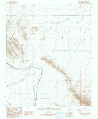
1990 Map of Bouse Hills East
USGS Topo · Published 1990About this map
The Hayden-Rhodes Aqueduct cuts a definitive path across this arid landscape, passing through a Tunnel beneath the southern reach of the Bouse Hills. This 1990 provisional survey documents the critical water infrastructure of the Central Arizona Project as it skirts the western edge of the Granite Wash Mountains. The map reveals a land transition from the high, rocky terrain of the hills down into the broad expanses of the Butler Valley and the Ranegras Plain.
Find a feature on this map
22 named features on this map. Tap any name to fly to it.
Don’t see what you’re looking for? This feature index may not catch every label — zoom into the map to look around manually.
Map Details
Editions of this 1990 Bouse Hills East Map
This is the sole edition of this map. No revisions or reprints were ever made.
Other maps of this area

1923 · Signal
USGS Topo · 1:250,000

1942 · Signal
USGS Topo · 1:250,000

1942 · Vicksburg
USGS Topo · 1:250,000

1950 · Prescott
USGS Topo · 1:250,000

1954 · Prescott
USGS Topo · 1:250,000

1954 · Phoenix
USGS Topo · 1:250,000

1957 · Phoenix
USGS Topo · 1:250,000

1958 · Prescott
USGS Topo · 1:250,000

1958 · Phoenix
USGS Topo · 1:250,000

1959 · Prescott
USGS Topo · 1:250,000