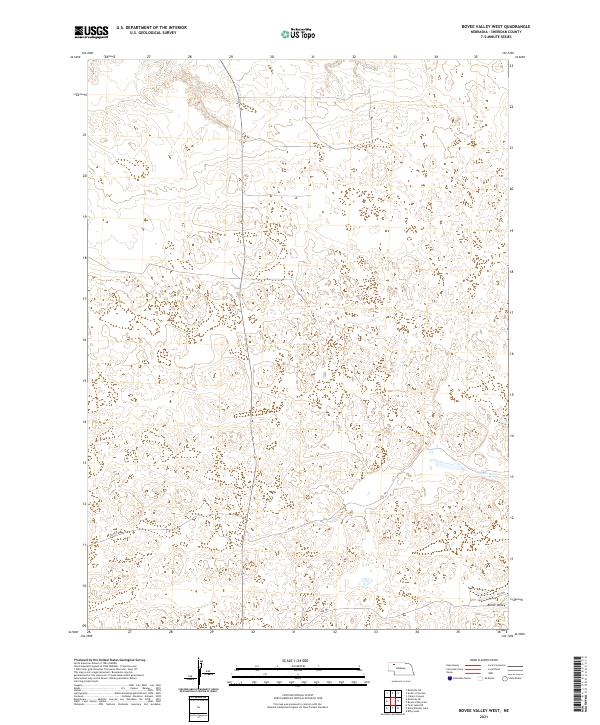
2021 Map of Bovee Valley West
USGS Topo · Published 2021About this map
Bovee Valley defines the southeastern corner of this Sheridan County landscape, where the headwaters of the Snake River begin to carve through the high plains. The terrain is characterized by complex depressions and undulations typical of the Nebraska Sandhills, providing a look at a sparsely settled ranching environment in the early 21st century. Movement across this open country is defined by a network of numbered ranch roads and trails, including 457th Trl, 456 Trl, and 448 Trl, which trace the low-lying areas between sandy rises. The map preserves the exact legal divisions of the Public Land Survey System, showing the intersections of Townships 29, 30, and 31 North across Ranges 41 and 42 West. This documentation is essential for understanding land ownership and access in a region where natural landmarks are subtle and human infrastructure is limited to fundamental utility.
Find a feature on this map
12 named features on this map. Tap any name to fly to it.
Don’t see what you’re looking for? This feature index may not catch every label — zoom into the map to look around manually.
Map Details
Editions of this 2021 Bovee Valley West Map
This is the sole edition of this map. No revisions or reprints were ever made.
Other maps of this area

1948 · Twin Lakes
USGS Topo · 1:62,500

1948 · Spade Ranch
USGS Topo · 1:62,500

1950 · Twin Lakes
USGS Topo · 1:62,500

1950 · Spade Ranch
USGS Topo · 1:62,500

1955 · Alliance
USGS Topo · 1:250,000

1957 · Alliance
USGS Topo · 1:250,000

1958 · Alliance
USGS Topo · 1:250,000

1969 · Rushville 4 SW
USGS Topo · 1:24,000

1969 · Rushville SE
USGS Topo · 1:24,000
1969 · Rushville 4 NE
USGS Topo · 1:24,000