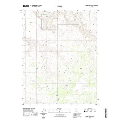
2020 Map of Bowdie Canyon East
USGS Topo · Published 2020About this map
The Colorado River and the upper reaches of Lake Powell dominate the northwestern corner of this territory, where the borders of Garfield and San Juan counties meet. Much of the landscape is defined by the high elevations of the Dark Canyon Plateau and the Plateau Region, cut by deep drainages such as Gypsum Canyon and Bowdie Canyon. Most of the land falls within the Glen Canyon National Recreation Area, showing a wilderness transition from the riverbanks to the high plateau country. Sweet Alice Rd serves as the primary corridor through the southern half of the map, providing access to remote points like Lean-To Point and Black Point. This modern survey illustrates the current topographic state of these canyons and highlands, including named landmarks like Ocean Point and the archaeological surroundings of Fable Valley.
Find a feature on this map
21 named features on this map. Tap any name to fly to it.
Don’t see what you’re looking for? This feature index may not catch every label — zoom into the map to look around manually.
Map Details
Editions of this 2020 Bowdie Canyon East Map
This is the sole edition of this map. No revisions or reprints were ever made.
Other maps of this area

1885 · San Rafael
USGS Topo · 1:250,000

1885 · La Sal
USGS Topo · 1:250,000

1886 · Henry Mountains
USGS Topo · 1:250,000

1886 · Abajo
USGS Topo · 1:250,000

1892 · Abajo
USGS Topo · 1:250,000

1892 · Henry Mountains
USGS Topo · 1:250,000

1893 · Abajo
USGS Topo · 1:250,000

1935 · Elk Ridge
USGS Topo · 1:96,000

1940 · Elk Ridge
USGS Topo · 1:125,000

1952 · Mouth of Dark Canyon
USGS Topo · 1:62,500