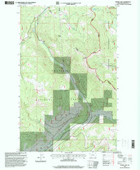
1997 Map of Bowen Lake
USGS Topo · Published 2000About this map
Kootenai National Forest dominates this landscape in northwest Montana, where a complex network of forest roads and watercourses defines the land use in the late 20th century. The topography is anchored by the Elk Divide and Elk Mountain, serving as a high-altitude spine between drainages like Wolf Creek and Gray Creek. An industrial legacy is visible in the presence of a Railroad Tunnel cutting through the mountainous terrain near the northern boundary, as well as a Gravel Pit located near the Fisher River. The map highlights the intersection of heavy transit and natural resources, showing established routes such as the Tally Lake Fortine Rd and Tally Lake Fisher River Rd that weave through the national forest lands. Local features like Bowen Lake and Brush Creek provide specific points of interest for those studying the hydrologic and recreational layout of the region during this era.
Find a feature on this map
18 named features on this map. Tap any name to fly to it.
Don’t see what you’re looking for? This feature index may not catch every label — zoom into the map to look around manually.
Map Details
Editions of this 1997 Bowen Lake Map
This is the sole edition of this map. No revisions or reprints were ever made.
Other maps of this area

1913 · Stryker
USGS Topo · 1:125,000

1916 · Stryker
USGS Topo · 1:125,000

1920 · Jennings
USGS Topo · 1:125,000

1935 · Thompson Lakes
USGS Topo · 1:96,000

1942 · Thompson Lakes
USGS Topo · 1:125,000

1957 · Kalispell
USGS Topo · 1:250,000

1960 · Kalispell
USGS Topo · 1:250,000

1961 · Kalispell
USGS Topo · 1:250,000

1963 · Wolf Prairie
USGS Topo · 1:24,000

1963 · Davis Mountain
USGS Topo · 1:24,000