
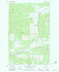
1963 Map of Wolf Prairie
USGS Topo · Published 1965About this map
Kootenai National Forest dominates this mountain landscape, defined by a network of drainage systems feeding into Wolf Creek. In the early 1960s, human activity was concentrated along the narrow valley floors, most notably at the French 8 Ranch and the nearby Fairview Guard Station. The map illustrates a landscape of high ridges and peaks, including Sugarloaf Mountain and Redemption Hill, accessed primarily by a primitive Pack Trail. A small Gravel Pit near Wolf Creek suggests localized maintenance or resource extraction during this era. The hydrological pattern is intricate, with Betts Lake sitting as a rare body of still water amidst numerous descending streams like Syrup Creek and Kavalla Creek. This survey provides a record of the remote timber and ranching outposts within Lincoln County before significant modern developments altered the character of these mountain valleys.
Find a feature on this map
17 named features on this map. Tap any name to fly to it.
Don’t see what you’re looking for? This feature index may not catch every label — zoom into the map to look around manually.
Map Details
Editions of this 1963 Wolf Prairie Map
2 editions found
Other maps of this area

1920 · Jennings
USGS Topo · 1:125,000

1935 · Thompson Lakes
USGS Topo · 1:96,000

1942 · Thompson Lakes
USGS Topo · 1:125,000

1957 · Kalispell
USGS Topo · 1:250,000

1960 · Kalispell
USGS Topo · 1:250,000

1961 · Kalispell
USGS Topo · 1:250,000

1963 · Warland Peak
USGS Topo · 1:24,000

1963 · Cripple Horse Mountain
USGS Topo · 1:24,000
1963 · Bowen Lake
USGS Topo · 1:24,000
1963 · Horse Hill
USGS Topo · 1:24,000