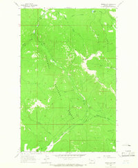
1963 Map of Bowen Lake
USGS Topo · Published 1966About this map
Kootenai National Forest dominates this mountain landscape, recorded here in the early 1960s. The topography is defined by the sharp rise of Elk Mountain and the curving spine of the Elk Divide, which separates the drainage systems of the region. A network of Pack Trails provides the primary means of navigation through the high country, connecting remote drainages like Wolf Creek and Rock Creek.
Find a feature on this map
14 named features on this map. Tap any name to fly to it.
Don’t see what you’re looking for? This feature index may not catch every label — zoom into the map to look around manually.
Map Details
Editions of this 1963 Bowen Lake Map
2 editions found
Other maps of this area

1913 · Stryker
USGS Topo · 1:125,000

1916 · Stryker
USGS Topo · 1:125,000

1920 · Jennings
USGS Topo · 1:125,000

1935 · Thompson Lakes
USGS Topo · 1:96,000

1942 · Thompson Lakes
USGS Topo · 1:125,000

1957 · Kalispell
USGS Topo · 1:250,000

1960 · Kalispell
USGS Topo · 1:250,000

1961 · Kalispell
USGS Topo · 1:250,000

1963 · Wolf Prairie
USGS Topo · 1:24,000

1963 · Davis Mountain
USGS Topo · 1:24,000