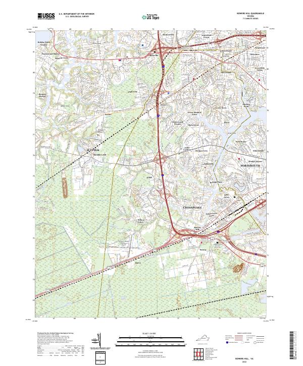
2022 Map of Bowers Hill
USGS Topo · Published 2022About this map
Great Dismal Swamp reaches into the southern portion of this landscape, where the N-Ditch borders a transition from protected wetlands to the developed corridors of Suffolk and Chesapeake. The map illustrates a complex network of waterways, including Bennett Creek and Knotts Creek, which define the residential peninsulas of Knotts Neck and Quaker Neck. Infrastructure and industry are prominent, with the Suffolk Seaboard Coastline Trl tracing former rail routes and the Hampton Roads Executive Airport serving as a regional aviation hub. Local heritage is preserved in several burial grounds, such as the Triangle Cem and Churchland Baptist Cem, which sit alongside established communities like Pughsville and Boone. The convergence of Hodges Ferry and Jolliff highlights the area's historical reliance on both water crossings and inland road networks for local commerce and connectivity.
Find a feature on this map
92 named features on this map. Tap any name to fly to it.
Don’t see what you’re looking for? This feature index may not catch every label — zoom into the map to look around manually.
Map Details
Editions of this 2022 Bowers Hill Map
This is the sole edition of this map. No revisions or reprints were ever made.
Other maps of this area

1907 · Norfolk
USGS Topo · 1:125,000

1919 · Smithfield
USGS Topo · 1:62,500

1919 · Suffolk
USGS Topo · 1:62,500

1921 · Newport News
USGS Topo · 1:62,500

1940 · Lake Drummond
USGS Topo · 1:62,500

1944 · Norfolk South
USGS Topo · 1:25,000

1945 · Lake Drummond
USGS Topo · 1:62,500

1948 · Norfolk South
USGS Topo · 1:24,000
1948 · Norfolk North
USGS Topo · 1:24,000

1949 · Chuckatuck
USGS Topo · 1:24,000