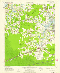
1955 Map of Bowers Hill
USGS Topo · Published 1958About this map
The Western Branch of the Elizabeth River dominates this mid-1950s landscape, serving as a focal point for burgeoning residential developments like Sterling Point and Park Manor. The map reveals a transition from the agricultural and tidal landscapes of Knotts Neck toward the industrial and infrastructure corridors near Bowers Hill. Five different railroad lines, including the Virginian and Seaboard Air Line, converge in the southern sector, illustrating the region's importance as a transportation hub.
Find a feature on this map
67 named features on this map. Tap any name to fly to it.
Don’t see what you’re looking for? This feature index may not catch every label — zoom into the map to look around manually.
Map Details
Editions of this 1955 Bowers Hill Map
This is the sole edition of this map. No revisions or reprints were ever made.
Other maps of this area

1907 · Norfolk
USGS Topo · 1:125,000

1919 · Smithfield
USGS Topo · 1:62,500

1919 · Suffolk
USGS Topo · 1:62,500

1921 · Newport News
USGS Topo · 1:62,500

1940 · Lake Drummond
USGS Topo · 1:62,500

1944 · Norfolk South
USGS Topo · 1:25,000

1945 · Lake Drummond
USGS Topo · 1:62,500

1948 · Norfolk South
USGS Topo · 1:24,000
1948 · Norfolk North
USGS Topo · 1:24,000

1949 · Chuckatuck
USGS Topo · 1:24,000