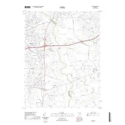
2019 Map of Bowie
USGS Topo · Published 2019About this map
The Patuxent River and Little Patuxent River form the winding boundary between Prince George's and Anne Arundel counties, serving as the central geographic feature of this suburban Maryland landscape. While modern residential developments like Bowie and Mitchellville dominate the western portion of the sheet, the area retains significant markers of its longer history. The site of Sacred Heart Catholic Ch and its associated Sacred Heart Catholic Cem near White Marsh Br stand as durable community anchors. The map documents several key crossings over the Patuxent, including Priest Bridge, Governor Bridge, and Queen Anne Bridge, which once linked established colonial-era crossroads. To the east, the terrain transitions into the more open spaces of Davidsonville, where Lakemont Memorial Gardens and the Fairview Airport reflect the area's continued evolution from rural agrarian roots toward mid-century aviation and modern land use.
Find a feature on this map
227 named features on this map. Tap any name to fly to it.
Don’t see what you’re looking for? This feature index may not catch every label — zoom into the map to look around manually.
Map Details
Editions of this 2019 Bowie Map
This is the sole edition of this map. No revisions or reprints were ever made.
Other maps of this area

1892 · Laurel
USGS Topo · 1:62,500

1892 · Owensville
USGS Topo · 1:62,500

1894 · Laurel
USGS Topo · 1:62,500

1894 · Relay
USGS Topo · 1:62,500

1895 · Owensville
USGS Topo · 1:62,500

1897 · Laurel
USGS Topo · 1:62,500

1899 · Patuxent
USGS Topo · 1:125,000

1900 · Washington
USGS Topo · 1:62,500

1905 · Owensville
USGS Topo · 1:62,500

1906 · Patuxent
USGS Topo · 1:125,000