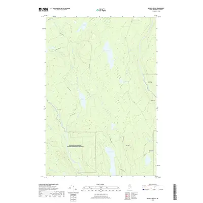
2018 Map of Bowlin Brook
USGS Topo · Published 2018About this map
The East Branch Penobscot River carves a dramatic course through this portion of Penobscot County, marked by river features like the rapids at Spencer Rips, the cascade at Bowlin Falls, and the notable Grand Pitch. This area, heavily integrated into the Katahdin Woods and Waters National Monument, reveals a landscape defined by its waterways and timber heritage. A network of logging roads, including Bowlin Camp Rd and Marble Ridge Rd, provides access to the interior ponds and ridges.
Find a feature on this map
37 named features on this map. Tap any name to fly to it.
Don’t see what you’re looking for? This feature index may not catch every label — zoom into the map to look around manually.
Map Details
Editions of this 2018 Bowlin Brook Map
This is the sole edition of this map. No revisions or reprints were ever made.
Other maps of this area

1927 · Katahdin
USGS Topo · 1:48,000

1930 · Katahdin
USGS Topo · 1:62,500

1949 · Katahdin
USGS Topo · 1:62,500

1953 · Stacyville
USGS Topo · 1:62,500

1954 · Shin Pond
USGS Topo · 1:62,500

1954 · Presque Isle
USGS Topo · 1:250,000

1954 · Millinocket
USGS Topo · 1:250,000

1955 · Traveler Mountain
USGS Topo · 1:62,500

1958 · Presque Isle
USGS Topo · 1:250,000

1958 · Millinocket
USGS Topo · 1:250,000