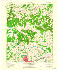
1959 Map of Bowling Green North
USGS Topo · Published 1960About this map
The Barren River defines the geography of this 1959 survey, winding through the heart of Warren County with dramatic oxbows like Buckner Bend. Along its banks, several significant islands are documented, including Sibert Island, Smith Island, and McFarland Island. To the south, the city of Bowling Green begins to expand into Delafield, with the Louisville and Nashville railroad corridor serving as a vital industrial artery near Jennings Creek.
Find a feature on this map
49 named features on this map. Tap any name to fly to it.
Don’t see what you’re looking for? This feature index may not catch every label — zoom into the map to look around manually.
Map Details
Editions of this 1959 Bowling Green North Map
This is the sole edition of this map. No revisions or reprints were ever made.
Other maps of this area

1914 · Little Muddy
USGS Topo · 1:62,500

1921 · Bowling Green
USGS Topo · 1:62,500

1922 · Brownsville
USGS Topo · 1:62,500

1923 · Bowling Green
USGS Topo · 1:62,500

1923 · Brownsville
USGS Topo · 1:62,500

1952 · Rockfield
USGS Topo · 1:24,000

1954 · Evansville
USGS Topo · 1:250,000

1954 · Bowling Green North
USGS Topo · 1:24,000

1954 · Bristow
USGS Topo · 1:24,000
1954 · Brownsville
USGS Topo · 1:24,000