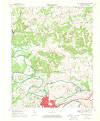
1968 Map of Bowling Green North
USGS Topo · Published 1969About this map
The Barren River defines this landscape as it meanders through Warren County, passing prominent landmarks like Slim Island and McFarland Island. North of the Bowling Green corporate boundary, the terrain transitions from urban development at Delafield to the rural ridges of Billy Goat Hill. This late 1960s survey documents a region defined by its water-and-rail economy, where the Louisville and Nashville tracks parallel the river's path.
Find a feature on this map
54 named features on this map. Tap any name to fly to it.
Don’t see what you’re looking for? This feature index may not catch every label — zoom into the map to look around manually.
Map Details
Editions of this 1968 Bowling Green North Map
This is the sole edition of this map. No revisions or reprints were ever made.
Other maps of this area

1914 · Little Muddy
USGS Topo · 1:62,500

1921 · Bowling Green
USGS Topo · 1:62,500

1922 · Brownsville
USGS Topo · 1:62,500

1923 · Bowling Green
USGS Topo · 1:62,500

1923 · Brownsville
USGS Topo · 1:62,500

1952 · Rockfield
USGS Topo · 1:24,000

1954 · Evansville
USGS Topo · 1:250,000

1954 · Bowling Green North
USGS Topo · 1:24,000

1954 · Bristow
USGS Topo · 1:24,000
1954 · Brownsville
USGS Topo · 1:24,000