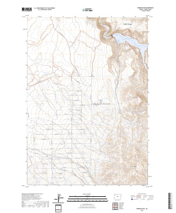
2024 Map of Bowman Dam
USGS Topo · Published 2024About this map
The Crooked River dominates the northern reaches of this Crook County landscape, feeding into the expansive Prineville Reservoir. Along the southern shore, Powder House Cove and Juniper Canyon mark the transition from the river valley to the rising volcanic uplands. The terrain is defined by prominent peaks like Taylor Butte and Bear Creek Butte, which overlook a network of seasonal drainages including Williamson Creek and Perry Creek. Evidence of modern land management and recreation is visible through the extensive trail system, including the Millican Plateau Tr 84 Trl and various other numbered routes on the Millican Plateau. The presence of the Agape Farm Airport and a grid of residential lanes named for trees—such as Redwood Ln and Myrtlewood Ln—points to contemporary rural development south of the reservoir.
Find a feature on this map
51 named features on this map. Tap any name to fly to it.
Don’t see what you’re looking for? This feature index may not catch every label — zoom into the map to look around manually.
Map Details
Editions of this 2024 Bowman Dam Map
This is the sole edition of this map. No revisions or reprints were ever made.
Other maps of this area

1946 · Eagle Rock
USGS Topo · 1:62,500

1948 · Eagle Rock
USGS Topo · 1:62,500

1955 · Crescent
USGS Topo · 1:250,000

1955 · Bend
USGS Topo · 1:250,000

1957 · Crescent
USGS Topo · 1:250,000

1957 · Bend
USGS Topo · 1:250,000

1958 · Crescent
USGS Topo · 1:250,000

1958 · Bend
USGS Topo · 1:250,000

1962 · Powell Buttes
USGS Topo · 1:62,500

1967 · Brothers NW
USGS Topo · 1:24,000