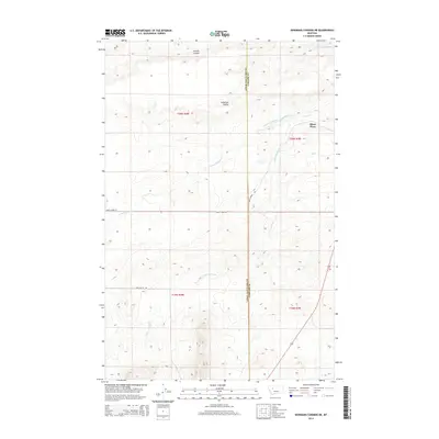
2014 Map of Bowmans Corners NE
USGS Topo · Published 2014About this map
Olson Place anchors the eastern edge of this landscape where the high plains of Cascade County meet the mountain foothills. The drainage system of Simms Creek defines the local geography, with the N Fork Simms Cr and S Fork Simms Cr carving distinct coulees across the terrain. Human modification of the arid environment is evident in the Crown Butte Canal, which follows the contours of the land to manage water resources. The county line between Lewis and Clark and Cascade counties runs north-to-south through the center of the map, bisecting a region of high ridges and deep draws. Landmarks like Long Butte and the winding Loomis Coulee provide essential orientation in a region largely defined by its natural topography and early ranching history.
Find a feature on this map
15 named features on this map. Tap any name to fly to it.
Don’t see what you’re looking for? This feature index may not catch every label — zoom into the map to look around manually.
Map Details
Editions of this 2014 Bowmans Corners NE Map
This is the sole edition of this map. No revisions or reprints were ever made.
Other maps of this area

1886 · Great Falls
USGS Topo · 1:250,000

1920 · Choteau
USGS Topo · 1:125,000

1943 · Hogan
USGS Topo · 1:125,000

1950 · Fairfield
USGS Topo · 1:62,500

1954 · Great Falls
USGS Topo · 1:250,000

1955 · Choteau
USGS Topo · 1:250,000

1957 · Choteau
USGS Topo · 1:250,000

1957 · Great Falls
USGS Topo · 1:250,000

1958 · Choteau
USGS Topo · 1:250,000

1960 · Simms
USGS Topo · 1:62,500