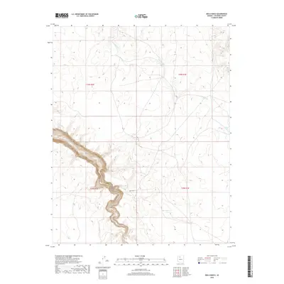
2018 Map of Box K Ranch
USGS Topo · Published 2018About this map
Cataract Canyon dominates this high-plateau landscape in northern Coconino County, where the sharp descent into the drainage of Cataract Creek marks a stark transition from the surrounding level topography. Centered on the Box K Ranch, the map captures a rural ranching environment defined by essential water management features. Isolated water sources like Box K Tank, Balboa Tank, and Bills Tank are scattered across the terrain, reflecting the vital infrastructure needed to support livestock and habitation in this arid region of Arizona.
Find a feature on this map
11 named features on this map. Tap any name to fly to it.
Don’t see what you’re looking for? This feature index may not catch every label — zoom into the map to look around manually.
Map Details
Editions of this 2018 Box K Ranch Map
This is the sole edition of this map. No revisions or reprints were ever made.
Other maps of this area
1886 · Chino
USGS Topo · 1:250,000
1886 · Kaibab
USGS Topo · 1:250,000
1891 · Chino
USGS Topo · 1:250,000
1948 · Williams
USGS Topo · 1:250,000

1953 · Grand Canyon
USGS Topo · 1:250,000
1954 · Williams
USGS Topo · 1:250,000
1956 · Williams
USGS Topo · 1:250,000

1957 · Grand Canyon
USGS Topo · 1:250,000

1958 · Grand Canyon
USGS Topo · 1:250,000
1960 · Williams
USGS Topo · 1:250,000