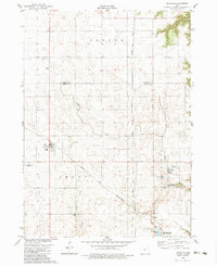
1982 Map of Boxholm
USGS Topo · Published 1983About this map
Boxholm and Pilot Mound anchor this agricultural landscape in Boone County, where the transition from the upland prairie to the more varied terrain of the Des Moines River valley begins. The Chicago and North Western railroad cuts diagonally across the terrain, a vital infrastructure element for these rural Iowa communities in the early 1980s. The map reveals a high density of local heritage sites, from early rural education at Grand Sch to sacred grounds like Union Cem, Lawn Cem, and the noteworthy Pioneer Graves. Hydrological features like Beaver Creek and the man-made Don Williams Lake within Don Williams County Park provide a clear view of how water management and recreation shaped the local geography. The eastern edge of the quadrangle is defined by the wooded slopes of the Pilot Mound State Forest and the winding course of Bluff Creek.
Find a feature on this map
19 named features on this map. Tap any name to fly to it.
Don’t see what you’re looking for? This feature index may not catch every label — zoom into the map to look around manually.
Map Details
Editions of this 1982 Boxholm Map
This is the sole edition of this map. No revisions or reprints were ever made.
Other maps of this area

1916 · Boone
USGS Topo · 1:62,500

1923 · Lehigh
USGS Topo · 1:62,500

1951 · Ogden
USGS Topo · 1:62,500

1954 · Waterloo
USGS Topo · 1:250,000

1954 · Fort Dodge
USGS Topo · 1:250,000

1955 · Waterloo
USGS Topo · 1:250,000

1957 · Fort Dodge
USGS Topo · 1:250,000

1958 · Fort Dodge
USGS Topo · 1:250,000

1965 · Fraser
USGS Topo · 1:24,000

1965 · Lehigh
USGS Topo · 1:24,000