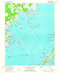
1964 Map of Boxiron
USGS Topo · Published 1966About this map
Boxiron sits at the head of Boxiron Creek, serving as a central point in this coastal landscape defined by a network of historic landings and extensive tidal marshes. The shoreline along Chincoteague Bay is dotted with sites like Figgs Landing, Scott Landing, and Truitt Landing, marking a maritime economy based on boat access to the bay's productive waters. Navigational channels like Assacorkin Thorofare and Muddy Thorofare weave between a complex archipelago of tumps and islands, including Mills Island and Tizzard Island. The southern portion of the sheet reaches the Maryland-Virginia state line, showing the early boundaries of the Chincoteague National Wildlife Refuge. Numerous family-named roads like Cherrix Road and Taylor Landing Road connect the inland timber and agricultural plots to the bay's edge.
Find a feature on this map
95 named features on this map. Tap any name to fly to it.
Don’t see what you’re looking for? This feature index may not catch every label — zoom into the map to look around manually.
Map Details
Editions of this 1964 Boxiron Map
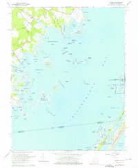
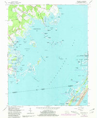
3 editions found
Other maps of this area

1901 · Snow Hill
USGS Topo · 1:62,500

1901 · Green Run
USGS Topo · 1:62,500

1938 · Green Run
USGS Topo · 1:62,500

1942 · Chincoteague East
USGS Topo · 1:24,000

1942 · Snow Hill
USGS Topo · 1:24,000

1942 · Tingles Island
USGS Topo · 1:24,000

1942 · Wesley
USGS Topo · 1:24,000

1943 · Snow Hill
USGS Topo · 1:31,680

1943 · Boxiron
USGS Topo · 1:31,680

1943 · Whittington Point
USGS Topo · 1:31,680