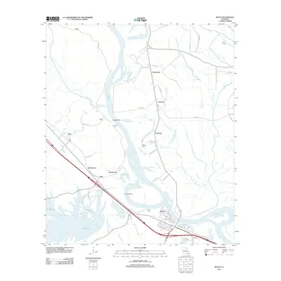
2012 Map of Boyce
USGS Topo · Published 2012About this map
Boyce serves as a focal point along the Red River, exhibiting a grid of streets like Wettermark St and Connaught Ave that define its riverside development. The landscape is deeply tied to the meandering river and its surrounding bayou systems, including the complex Cane River-Red Bayou Diversion Canal and Bayou Jean De Jean. Rural settlements such as Zimmerman, Kateland, and Fairmount are scattered across the floodplain, often located near distinctive landmarks like Deloges Bluff or the industrial waters of Lake Rodemacher. Genealogists will find a significant number of family and community burial grounds, including Saint Aloysius Cem, Bynum Cem, and Rose View Cem. The movement of water through features like Pontfield Bend and Labourne Bayou illustrates the historical reliance on these natural drainage patterns for both transit and agriculture in Rapides Parish.
Find a feature on this map
69 named features on this map. Tap any name to fly to it.
Don’t see what you’re looking for? This feature index may not catch every label — zoom into the map to look around manually.
Map Details
Editions of this 2012 Boyce Map
This is the sole edition of this map. No revisions or reprints were ever made.
Other maps of this area

1932 · Boyce NE
USGS Topo · 1:31,680

1932 · Boyce SW
USGS Topo · 1:31,680

1932 · Colfax SW
USGS Topo · 1:31,680

1932 · Colfax SE
USGS Topo · 1:31,680

1936 · Colfax
USGS Topo · 1:62,500

1937 · Chopin NE
USGS Topo · 1:31,680

1937 · Aloha
USGS Topo · 1:31,680

1937 · Montgomery
USGS Topo · 1:62,500

1937 · Chopin SE
USGS Topo · 1:31,680

1941 · Boyce
USGS Topo · 1:62,500