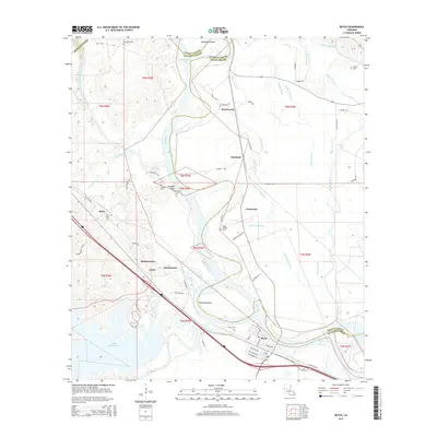
2015 Map of Boyce
USGS Topo · Published 2015About this map
Boyce serves as the focal point for this survey of the Red River valley, situated at a major bend in the waterway where the Red River defines the border between Rapides and Grant Parishes. The landscape is characterized by its intricate hydraulic network, featuring the McNeely Cut-Off and numerous bayous like Bayou Patassa and Bayou Rigolette that thread through the lowlands. Significant local landmarks include Lake Rodemacher to the southwest and the elevated Deloges Bluff overlooking the river. The map provides excellent detail for genealogists, documenting several rural burial sites such as Valentine Cem, Lacour Cem, and Saint Aloysius Cem. Small settlements like Zimmerman, Oasis, and Kateland are shown connected by a network of rural roads and canals, reflecting the area's agricultural and riverine character.
Find a feature on this map
72 named features on this map. Tap any name to fly to it.
Don’t see what you’re looking for? This feature index may not catch every label — zoom into the map to look around manually.
Map Details
Editions of this 2015 Boyce Map
This is the sole edition of this map. No revisions or reprints were ever made.
Other maps of this area

1932 · Boyce NE
USGS Topo · 1:31,680

1932 · Boyce SW
USGS Topo · 1:31,680

1932 · Colfax SW
USGS Topo · 1:31,680

1932 · Colfax SE
USGS Topo · 1:31,680

1936 · Colfax
USGS Topo · 1:62,500

1937 · Chopin NE
USGS Topo · 1:31,680

1937 · Aloha
USGS Topo · 1:31,680

1937 · Montgomery
USGS Topo · 1:62,500

1937 · Chopin SE
USGS Topo · 1:31,680

1941 · Boyce
USGS Topo · 1:62,500