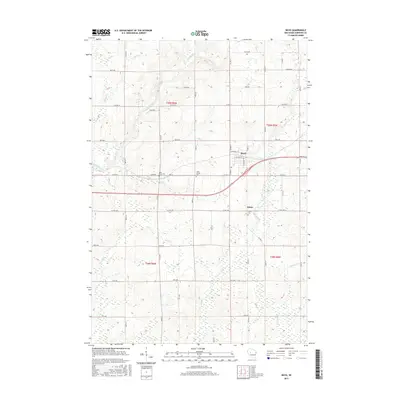
2015 Map of Boyd
USGS Topo · Published 2015About this map
Boyd and the neighboring settlement of Edson anchor this rural Chippewa County landscape, where the Yellow River and numerous tributaries like Seth Cr and Lotz Cr wind through the township grids. This 2015 update shows the area's agricultural and religious roots through well-established local sites, including Saint Peter Cem, Saint Joseph Cem, and Union Cem. The transport network is a mix of traditional county highways such as Co HWY X and Co HWY O alongside the more modern corridor of Bus 29. The map's layout highlights the transition from the concentrated street grid of Boyd, featuring N Rose St and Adams St, to the broader sprawling farmlands crossed by Sherman Cr and Muskrat Cr. This survey provides a clear view of the hydrological patterns of the region, where Paint Cr and Hay Cr drain into the primary river system.
Find a feature on this map
43 named features on this map. Tap any name to fly to it.
Don’t see what you’re looking for? This feature index may not catch every label — zoom into the map to look around manually.
Map Details
Editions of this 2015 Boyd Map
This is the sole edition of this map. No revisions or reprints were ever made.
Other maps of this area

1951 · Cornell
USGS Topo · 1:62,500

1951 · Gilman
USGS Topo · 1:62,500

1952 · Cadott
USGS Topo · 1:62,500

1952 · Stanley
USGS Topo · 1:62,500

1953 · Eau Claire
USGS Topo · 1:250,000

1953 · Rice Lake
USGS Topo · 1:250,000

1958 · Eau Claire
USGS Topo · 1:250,000

1959 · Rice Lake
USGS Topo · 1:250,000

1964 · Eau Claire
USGS Topo · 1:250,000
1973 · Colburn
USGS Topo · 1:24,000