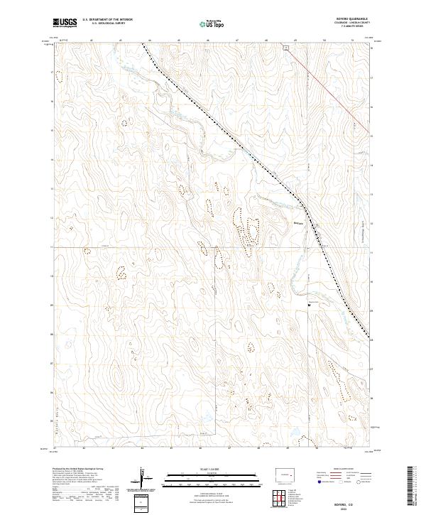
2022 Map of Boyero
USGS Topo · Published 2022About this map
Boyero serves as the primary focal point of this high-plains landscape, situated along the diagonal path of Big Sandy Creek. The settlement's infrastructure is closely tied to its environment, with Big Sandy Creek defining the natural drainage pattern while human footprints are preserved at the Boyero Cem. This area of eastern Colorado exhibits the characteristic township and range grid, where section lines are followed by local routes like Co Hwy 63 and Co Rd 41. To the west and east, the terrain is marked by distinct landforms including the depression of Buffalo Basin and the carved path of Schoolhouse Gulch. These features suggest a history of seasonal water management and grazing in a region defined by its wide-open topography.
Find a feature on this map
19 named features on this map. Tap any name to fly to it.
Don’t see what you’re looking for? This feature index may not catch every label — zoom into the map to look around manually.
Map Details
Editions of this 2022 Boyero Map
This is the sole edition of this map. No revisions or reprints were ever made.
Other maps of this area

1891 · Arroyo
USGS Topo · 1:125,000

1893 · Arroyo
USGS Topo · 1:125,000

1954 · Limon
USGS Topo · 1:250,000

1954 · Lamar
USGS Topo · 1:250,000

1957 · Limon
USGS Topo · 1:250,000

1958 · Limon
USGS Topo · 1:250,000

1958 · Lamar
USGS Topo · 1:250,000
1978 · Kinney Lake
USGS Topo · 1:24,000

1978 · Aroya
USGS Topo · 1:24,000

1978 · Rock Basin
USGS Topo · 1:24,000