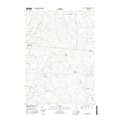
2016 Map of Boylston Center
USGS Topo · Published 2016About this map
The Jefferson Co and Oswego Co border divides this rural Tug Hill landscape, where small hamlets like Boylston Center and East Boylston are linked by a network of local routes including Co Rte 13 and Co Rte 17. The terrain is defined by a dense drainage system of creeks such as Bear Cr, Skinner Cr, and Trout Brook, which flow through wooded areas toward the Tamarack Swamp in the south. Genealogists will find several burial sites preserved on this sheet, including the Phelps Cem, Saint Josephs Cem, and Greenboro Cem. The landscape transitions from the higher elevations near Shoecraft Hill down toward the managed lands of the Little John Mgt Area Sthy in the southeast. This survey captures a rural New York region of small crossroads settlements like Smartville and Winona that have maintained their footprint into the twenty-first century.
Find a feature on this map
56 named features on this map. Tap any name to fly to it.
Don’t see what you’re looking for? This feature index may not catch every label — zoom into the map to look around manually.
Map Details
Editions of this 2016 Boylston Center Map
This is the sole edition of this map. No revisions or reprints were ever made.
Other maps of this area

1893 · Sackets Harbor
USGS Topo · 1:62,500

1895 · Sacketts Harbor
USGS Topo · 1:62,500

1895 · Pulaski
USGS Topo · 1:62,500

1895 · Watertown
USGS Topo · 1:62,500

1898 · Watertown
USGS Topo · 1:62,500

1903 · Orwell
USGS Topo · 1:62,500

1905 · Orwell
USGS Topo · 1:62,500

1908 · Watertown
USGS Topo · 1:62,500

1909 · Watertown
USGS Topo · 1:62,500

1942 · Sandy Creek
USGS Topo · 1:24,000