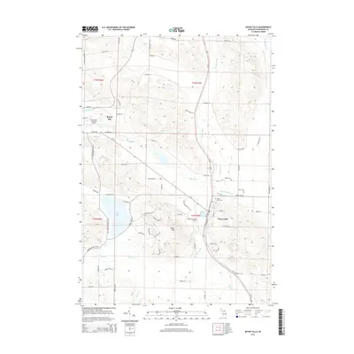
2014 Map of Boyne Falls
USGS Topo · Published 2014About this map
Boyne City and Boyne Falls anchor this survey of Charlevoix County, where the topography is defined by the significant rise of Boyne Mtn. The landscape is a complex network of waterways, centered on the Boyne River and its various tributaries including Hay Marsh Cr and Schoolhouse Cr. To the west, the large expanse of Deer Lake dominates the terrain, fed by Deer Cr and Warner Cr.
Find a feature on this map
84 named features on this map. Tap any name to fly to it.
Don’t see what you’re looking for? This feature index may not catch every label — zoom into the map to look around manually.
Map Details
Editions of this 2014 Boyne Falls Map
This is the sole edition of this map. No revisions or reprints were ever made.
Other maps of this area

1955 · Cheboygan
USGS Topo · 1:250,000

1958 · Cheboygan
USGS Topo · 1:250,000

1958 · Bayshore
USGS Topo · 1:62,500

1958 · Petoskey
USGS Topo · 1:62,500

1961 · Boyne Falls
USGS Topo · 1:62,500

1961 · Boyne City
USGS Topo · 1:62,500

1975 · Petoskey SW
USGS Topo · 1:24,000

1975 · Boyne City NE
USGS Topo · 1:24,000

1982 · Petoskey
USGS Topo · 1:100,000
1983 · Bay Shore
USGS Topo · 1:25,000