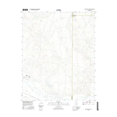
2016 Map of Boys Ranch East
USGS Topo · Published 2016About this map
Boys Ranch sits at the southwestern corner of this survey, marking a legacy of settlement along the northern banks of the Canadian River. The landscape is defined by an intricate network of drainages and seasonal watercourses, including Pescado Cr, Tascosa Cr, and Lit Cr, which carve through the plains of Potter and Oldham counties. For genealogists and local historians, the presence of the Tascosa Cem and the Casimiro Romero Cem provides critical points of connection to the early residents and pioneering families of this Texas Panhandle region. Transportation in this corner of the state is facilitated by Ranch Rd 1061 and local routes like Willis Loop, which connect the ranching community to the wider landscape. The topography reveals the transition from the high plains down to the riparian environment of the river valley, evidenced by the many tributaries such as Cottonwood Cr and W Indian Cr.
Find a feature on this map
18 named features on this map. Tap any name to fly to it.
Don’t see what you’re looking for? This feature index may not catch every label — zoom into the map to look around manually.
Map Details
Editions of this 2016 Boys Ranch East Map
This is the sole edition of this map. No revisions or reprints were ever made.
Other maps of this area

1934 · Ady
USGS Topo · 1:62,500

1936 · Ady
USGS Topo · 1:62,500

1954 · Tucumcari
USGS Topo · 1:250,000

1958 · Tucumcari
USGS Topo · 1:250,000
1966 · Boden
USGS Topo · 1:24,000

1966 · Halfway Creek
USGS Topo · 1:24,000

1966 · Ady
USGS Topo · 1:24,000

1971 · Bivins Channing Ranch
USGS Topo · 1:24,000

1971 · Boys Ranch West
USGS Topo · 1:24,000
1971 · Little Indian Creek
USGS Topo · 1:24,000