
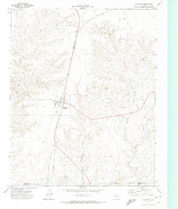
1971 Map of Bivins Channing Ranch
USGS Topo · Published 1973About this map
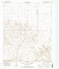
Bivins Channing Ranch and the nearby Bivins Channing Farm anchor this High Plains landscape at the boundary of Hartley, Moore, and Oldham Counties. The terrain is defined by the drainage networks of Cheyenne Creek and Rica Creek, which cut through the panhandle geography. This 1971 survey illustrates a region shaped by a specialized ranching and industrial economy, where private ranch roads connect a widespread network of Gas Wells and localized infrastructure like the Pumping Sta. The settlement of Heldon appears in the southeast corner near the Moore County line, while industrial activity is further evidenced by a Pipeline and scattered Gravel Pits. The presence of a prominent Indefinite Boundary adds a layer of cartographic interest for those researching local land divisions and ranch holdings during this era of Texas history.
Find a feature on this map
16 named features on this map. Tap any name to fly to it.
Don’t see what you’re looking for? This feature index may not catch every label — zoom into the map to look around manually.
Map Details
Editions of this 1971 Bivins Channing Ranch Map
2 editions found
Other maps of this area

1954 · Tucumcari
USGS Topo · 1:250,000

1958 · Tucumcari
USGS Topo · 1:250,000

1963 · Hartley SE
USGS Topo · 1:24,000

1963 · Bird Ranch Store
USGS Topo · 1:24,000

1963 · Stallwitz Lake
USGS Topo · 1:24,000

1971 · Boys Ranch West
USGS Topo · 1:24,000
1971 · Little Indian Creek
USGS Topo · 1:24,000
1971 · Boys Ranch East
USGS Topo · 1:24,000
1971 · Bautista
USGS Topo · 1:24,000
1971 · Channing
USGS Topo · 1:24,000