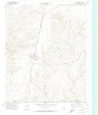
1971 Map of Channing
USGS Topo · Published 1974About this map
Channing serves as a small but vital hub on the Texas Panhandle, defined by the corridor of the Fort Worth and Denver railroad. The town layout is clearly established, including a local Cem and a dedicated Rodeo Ground that reflects the area's ranching heritage. The surrounding landscape in Hartley Co is characterized by the branching drainage systems of West Cheyenne Creek, Middle Cheyenne Creek, and East Cheyenne Creek, which cut through the high plains terrain.
Find a feature on this map
14 named features on this map. Tap any name to fly to it.
Don’t see what you’re looking for? This feature index may not catch every label — zoom into the map to look around manually.
Map Details
Editions of this 1971 Channing Map
This is the sole edition of this map. No revisions or reprints were ever made.
Other maps of this area

1954 · Tucumcari
USGS Topo · 1:250,000

1958 · Tucumcari
USGS Topo · 1:250,000

1963 · Hartley SE
USGS Topo · 1:24,000

1963 · Bird Ranch Store
USGS Topo · 1:24,000

1971 · Bivins Channing Ranch
USGS Topo · 1:24,000

1971 · Channing NW
USGS Topo · 1:24,000

1971 · Boys Ranch West
USGS Topo · 1:24,000
1971 · Boys Ranch East
USGS Topo · 1:24,000
1971 · Torrey House
USGS Topo · 1:24,000

1972 · Hartley SW
USGS Topo · 1:24,000