
1972 Map of Hartley SW
USGS Topo · Published 1975About this map
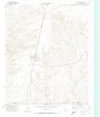
Rita Blanca Creek cuts a jagged path through the high plains of the Texas Panhandle, defining the dramatic topographic relief in this 1970s survey. The landscape is a study in the transition from flat prairie grazing lands to the deeply eroded breaks of the Canadian River watershed. While much of the land is managed through a network of fence lines, the northeastern corner of the map centers on the Fort Worth and Denver railroad corridor, a vital artery for the region's cattle and grain transport. Local history is anchored at Hartley Cem and the small settlement of Collins, while the presence of a Gravel Pit and scattered wells suggest the ongoing ranching and industrial utility of the terrain. The contrast between the stark, flat tablelands and the complex canyon system of the creek provides a clear view of the geological character of Hartley County.
Find a feature on this map
9 named features on this map. Tap any name to fly to it.
Don’t see what you’re looking for? This feature index may not catch every label — zoom into the map to look around manually.
Map Details
Editions of this 1972 Hartley SW Map
This is the sole edition of this map. No revisions or reprints were ever made.
Other maps of this area

1954 · Tucumcari
USGS Topo · 1:250,000

1958 · Tucumcari
USGS Topo · 1:250,000

1963 · Hartley SE
USGS Topo · 1:24,000

1963 · Hartley NE
USGS Topo · 1:24,000

1971 · Proctor Ranch
USGS Topo · 1:24,000

1971 · Channing NW
USGS Topo · 1:24,000
1971 · Channing
USGS Topo · 1:24,000

1973 · Pardue Camp
USGS Topo · 1:24,000

1973 · Hartley
USGS Topo · 1:24,000
1973 · King SE
USGS Topo · 1:24,000