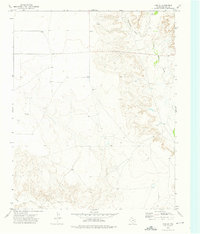
1973 Map of King SE
USGS Topo · Published 1976About this map
Rita Blanca Creek carves a deep path through the High Plains of Hartley County in this early 1970s topographical record. The landscape is defined by the sharp transition between flat upland plateaus and the intricate, branching drainage systems of Cottonwood Draw and Punta de Agua Creek. Human presence is sparse and focused on water access and resource extraction, with names like Reynolds and Bishop Well marking small points of settlement or activity in an otherwise expansive ranching environment.
Find a feature on this map
7 named features on this map. Tap any name to fly to it.
Don’t see what you’re looking for? This feature index may not catch every label — zoom into the map to look around manually.
Map Details
Editions of this 1973 King SE Map
This is the sole edition of this map. No revisions or reprints were ever made.
Other maps of this area

1954 · Tucumcari
USGS Topo · 1:250,000

1958 · Tucumcari
USGS Topo · 1:250,000

1971 · Proctor Ranch
USGS Topo · 1:24,000

1971 · Channing NW
USGS Topo · 1:24,000

1971 · Pedarosa Camp
USGS Topo · 1:24,000

1972 · Hartley SW
USGS Topo · 1:24,000

1973 · Pardue Camp
USGS Topo · 1:24,000

1973 · King SW
USGS Topo · 1:24,000

1973 · Hartley
USGS Topo · 1:24,000

1973 · King
USGS Topo · 1:24,000