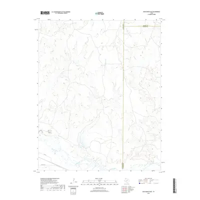
2019 Map of Boys Ranch East
USGS Topo · Published 2019About this map
Tascosa Cem and the nearby Casimiro Romero Cem anchor the historic landscape of the Texas Panhandle, positioned near the northern banks of the Canadian River. This 2019 survey documents a terrain defined by deep creek drainages and high plains, where the Oldham and Potter County line bisects a network of ephemeral watercourses like Tascosa Cr and Pescado Cr. The presence of these family and community burial sites suggests a long-standing ranching heritage in an area where local travel relies on routes such as Ranch Rd 1061. Settlement patterns here follow the river valley, with the Pescado Cr Lake and numerous tributary branches, including Cottonwood Cr and W Indian Cr, illustrating the vital connection between water access and land use in this semi-arid region.
Find a feature on this map
16 named features on this map. Tap any name to fly to it.
Don’t see what you’re looking for? This feature index may not catch every label — zoom into the map to look around manually.
Map Details
Editions of this 2019 Boys Ranch East Map
This is the sole edition of this map. No revisions or reprints were ever made.
Other maps of this area

1934 · Ady
USGS Topo · 1:62,500

1936 · Ady
USGS Topo · 1:62,500

1954 · Tucumcari
USGS Topo · 1:250,000

1958 · Tucumcari
USGS Topo · 1:250,000
1966 · Boden
USGS Topo · 1:24,000

1966 · Halfway Creek
USGS Topo · 1:24,000

1966 · Ady
USGS Topo · 1:24,000

1971 · Bivins Channing Ranch
USGS Topo · 1:24,000

1971 · Boys Ranch West
USGS Topo · 1:24,000
1971 · Little Indian Creek
USGS Topo · 1:24,000