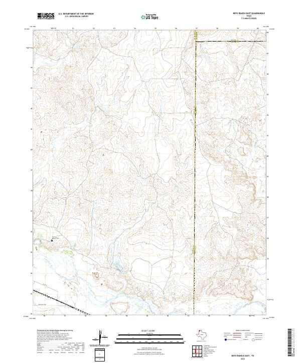
2022 Map of Boys Ranch East
USGS Topo · Published 2022About this map
The Casimiro Romero Cem serves as a lone cultural landmark on this high plains landscape where the borders of Oldham, Moore, and Potter counties converge. The terrain is defined by a dense network of intermittent drainages including Tascosa Cr, Rica Cr, and Pescado Cr, which cut through the tableland toward the southern basin. These seasonal waterways eventualy feed into the wider braided channel of the Canadian River, which dominates the southern edge of the quadrangle. A notable localized water feature, Pescado Cr Lake, sits just north of the river bottoms.
Find a feature on this map
16 named features on this map. Tap any name to fly to it.
Don’t see what you’re looking for? This feature index may not catch every label — zoom into the map to look around manually.
Map Details
Editions of this 2022 Boys Ranch East Map
This is the sole edition of this map. No revisions or reprints were ever made.
Other maps of this area

1934 · Ady
USGS Topo · 1:62,500

1936 · Ady
USGS Topo · 1:62,500

1954 · Tucumcari
USGS Topo · 1:250,000

1958 · Tucumcari
USGS Topo · 1:250,000
1966 · Boden
USGS Topo · 1:24,000

1966 · Halfway Creek
USGS Topo · 1:24,000

1966 · Ady
USGS Topo · 1:24,000

1971 · Bivins Channing Ranch
USGS Topo · 1:24,000

1971 · Boys Ranch West
USGS Topo · 1:24,000
1971 · Little Indian Creek
USGS Topo · 1:24,000