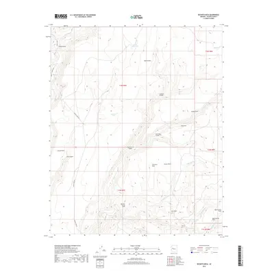
2018 Map of Bozarth Mesa
USGS Topo · Published 2018About this map
Bozarth Mesa dominates this 2018 survey of western Yavapai County, where the high tablelands of Arizona meet the eastern edges of the Mojave Desert. This landscape is defined by its water management and grazing heritage, shown through scattered water sources such as Brushy Basin Tank, Tod Reese Tank, and Urie Spring. The terrain is deeply incised by a network of drainages including Seligman Canyon, Zana Canyon, and Stone-Corral Canyon, which feed into larger watercourses like Burro Cr and Francis Cr. Human presence is marked primarily by Frances Creek Rd and named landmarks like Butcher Corral Point, suggesting a history tied to ranching and livestock movement through Urie Basin and across the mesa tops.
Find a feature on this map
33 named features on this map. Tap any name to fly to it.
Don’t see what you’re looking for? This feature index may not catch every label — zoom into the map to look around manually.
Map Details
Editions of this 2018 Bozarth Mesa Map
This is the sole edition of this map. No revisions or reprints were ever made.
Other maps of this area

1923 · Signal
USGS Topo · 1:250,000

1942 · Signal
USGS Topo · 1:250,000

1945 · Bagdad
USGS Topo · 1:62,500

1948 · Bagdad
USGS Topo · 1:62,500

1950 · Prescott
USGS Topo · 1:250,000

1954 · Prescott
USGS Topo · 1:250,000

1958 · Prescott
USGS Topo · 1:250,000

1959 · Prescott
USGS Topo · 1:250,000

1960 · Prescott
USGS Topo · 1:250,000

1965 · Prescott
USGS Topo · 1:250,000