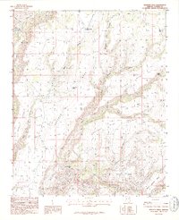
1986 Map of Bozarth Mesa
USGS Topo · Published 1986About this map
Bozarth Mesa dominates this high-altitude landscape of central Arizona, where an intricate network of deep canyons and mesa tops supported the region's ranching and water management systems in the 1980s. The topography is defined by significant elevation drops from Wilder Point and Contreras Mesa down into the winding beds of Francis Creek and Boulder Creek. A reliance on carefully managed water sources is evident through scattered infrastructure such as Brushy Basin Tank, Tod Reese Tank, and the Pumping Station near Zana Canyon. Evidence of land use and small-scale exploration appears in family-named landmarks like Butcher Corral Point and a lone Prospect located near the southern drainage. The map reveals the isolation of Behm Mesa and the lower Urie Basin, areas where seasonal flows like Warm Spring Creek and Cold Spring provided vital resources in an otherwise arid environment.
Find a feature on this map
23 named features on this map. Tap any name to fly to it.
Don’t see what you’re looking for? This feature index may not catch every label — zoom into the map to look around manually.
Map Details
Editions of this 1986 Bozarth Mesa Map
This is the sole edition of this map. No revisions or reprints were ever made.
Other maps of this area

1923 · Signal
USGS Topo · 1:250,000

1942 · Signal
USGS Topo · 1:250,000

1945 · Bagdad
USGS Topo · 1:62,500

1948 · Bagdad
USGS Topo · 1:62,500

1950 · Prescott
USGS Topo · 1:250,000

1954 · Prescott
USGS Topo · 1:250,000

1958 · Prescott
USGS Topo · 1:250,000

1959 · Prescott
USGS Topo · 1:250,000

1960 · Prescott
USGS Topo · 1:250,000

1965 · Prescott
USGS Topo · 1:250,000